feature
Perth School Catchment Zones — Find Your Local Government School
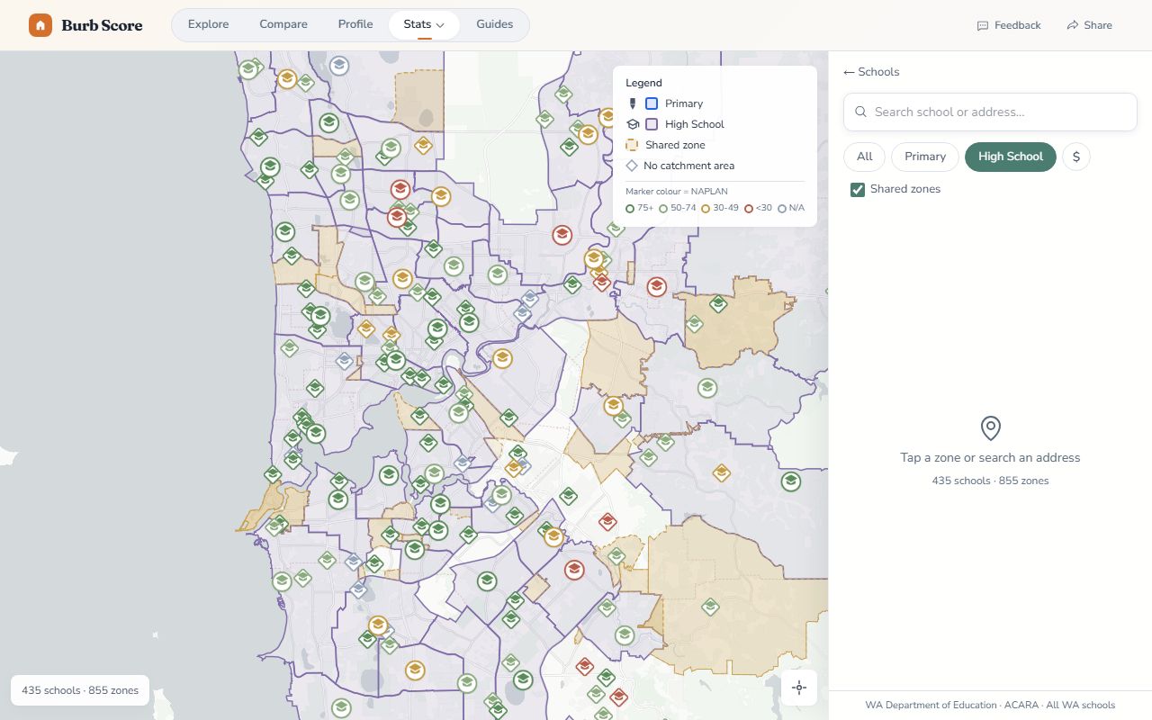
We added school catchment zone maps sourced from the WA Department of Education. Enter any Perth address and see exactly which government primary and secondary schools serve that location.
The map displays official intake area boundaries for every government school in the Perth metro area, so you can verify school zones before committing to a suburb.
How it works
- Search by address — type any Perth street address and the map centres on your location with catchment boundaries highlighted
- Primary & secondary — see both your local primary school and the secondary school intake area in one view
- NAPLAN ratings alongside — each school shows its BurbScore rating derived from NAPLAN reading, writing, and numeracy results
School zones are one of the biggest factors in Perth suburb choice, especially for families. Combined with our suburb school ratings, catchment maps give you the full picture — which school you’ll actually be zoned for, and how it performs academically.
Want to know when we ship something new?
Join the newsletter — no spam, just feature updates.